Thursday 31 May 2012

Fatty bumpkins

I'll happy admit to being greedy - I blame my genes as food has always been a high priority with my family. This week's forecast has shown itself up in all its bulemic glory - one moment it"s gorging on a feast of low pressures, blocking highs and fattening up the swell like a plump turkey. The next, its puking westerly winds all over the place like some sort of errant teenager after a cider binge.
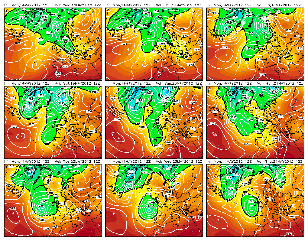
Often when there is extra-hurricular activity going on out in the Atlantic, the forecasts models can't handle the extra warmth and moisture in the atmosphere and the charts go haywire. The dregs of hurricane Beryl are wafting around out there and although wild talk of amazing waves earlier in the week might have been a tad over zealous, waves are acomin'. There'll be some half decent wave bopping around later tomorrow, all day on Saturday, and perhaps even on Monday if you can be persuaded by the log and the wind decides to play nicely.
Saturday in particular looks pretty dingish, with double digit periods and a metre plus of swell. Forecasting aficionados will know that's more than enough to get the pussy wet, metaphorically speaking of course.

Either way, I'm off to France for a stint so no doubt a week of shit waves are coming.
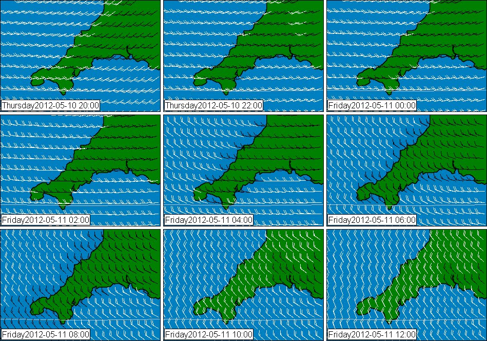
here's some charts.


They look good but by the time the waves arrive so do the onshores.

Friday 25 May 2012

RELOAD

Perhaps this last batch of waves was a little over hyped and if never quite got perfect, but of course, it's been a million times better than the past couple of months... and aside from the FOG there's been some nice sunshine and warmth.

Over the past couple of days - the forecast charts have been battling it out between trying to build a high over western Europe and letting the lows through. It's becoming clearer now and it looks like the high wins, which is excellent news as this means south-easterly winds for much of next week and next weekend.

There's another growly one developing in the slot too so its looking like next weekend is going to be blessed with pumping surf, blistering sunshine.

Its log-time this weekend but there may be something a little more interesting kicking about later on Sunday than some of the forecasters are suggesting.

Monday 21 May 2012

The world and her wife.

Here she is look, cute isn't she.

http://img.meteogroup.com/meteo/ecmwf/Europe/2012052112/Europe_2012052112_pmsl_48.png


Sunday 20 May 2012

All change

A hiatus. At last the constant rattle of the westerly wind looks like clearing off and the way is now paved for the smooth tone of the south-easterly to take its place. At flipping last. There was a couple of months there when i thought it wouldn't end.
There's a new growth tree ring out there now and waves are trotting our way.
I suspect Wednesday'll be King - Tides aren't quite right for any pre or post work action so it'll have to be a day off. There'll be enough to be getting along with if you don't mind throwing the log around on Thursday and Friday.


Friday 18 May 2012

woo

Charts looking nice for a while - winds are swerving nicely towards the magic quadrant between ENE clockwise round to SSE.

here is 3 days time


here is 10 days frrrrom hence.


mmm

Wednesday 16 May 2012

There she blows

Some nicer looking forecast charts are appearing on the charts at about T+144 , that's six days from last night at midnight. The depression is half way across the Atlantic so add another couple of days (ish) for the swell to move east and you have waves in the latter half of next week. They won't be huge nor are they certain but fresh hope is there.


Monday 14 May 2012

For those lucky enough to have last Friday off, there were some waves kicking about and a few scraps were pawed over at other times last week. Pretty miserable takings by most accounts, skin, bones and gristle rather than any succulent flesh.

Meanwhile, the week ahead is as bad as its been in the last month but whats this coming on the horizon? A decent swell? If the EC is right stand by for a new proper swell from about next Wednesday/Thursday onwards, when a new slow moving proximal low develops 600 mile or so to the west-sou-west of Bishop Rock.


It looks like a reasonably weird looking chart sequence so i am not favoring it and most of the other modellers aren't gong for anything anywhere near as juicy so I'm not getting excited about this one.

Thursday 10 May 2012

The SHIP?

Here is tomorrow's wind forecast - Should be some interesting waves somewhere on the south coast...

Wednesday 2 May 2012

Robot voice ... It's getting more certain now Lionel.

More crap weather for the next few days - then it's party time.

As I alluded to a couple of days ago' things are changing and there is a lot more agreement coming through from the model providers on what might happen next week.

A big flabby low will develop in the west of the Atlantic, then win it's way east and start to dig in about next Monday or Tuesday.

An attendant high will also build over Germany making for a southerly shove across Europe.

It's going to become warmer, drier and there'll be more swell.


Get on.