Sunday 23 June 2013

Azores high is back

After all the huff and puff of this weekend - things look like calming down nicely this week, as high pressure sets out its towel on the beach and looks set to hang round for a bit. I think it will be a slow process before it warms up, as it will build in from the W, rather than the south-west, but anything has got to be better than this past weekend. You know the weather's shite if you've been surfing the South Coast in June.

Pretty much all week, there'll be a NW wind and there's enough going on up around the NW Atlantic to make things look interesting around the weekend. But one thing to watch is Tuesday morning - as low pressure leaves and before the new high establishes itself, there'll be a spell of rather slack wind and a couple of feet to be getting on with, maybe even the odd three footer, so if you can find a nice bank and a log before breakfast, I'm sure there'll be some fun.


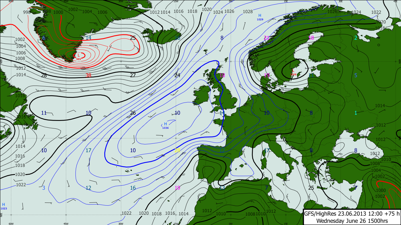
Wednesday's Atlantic chart above shows the next developing situation - it's not ideal - the main pulse of the swell from the Low near Greenland isn't going to be going to be thrusting towards Corn, but there may be a bit of spatter coming our way, so the weekend is certainly worth a sniff at this stage. Especially as the European forecasters want to pull the centre of the high across Southern England and into the Channel by Sunday, and that will make for offshore winds on the north shore.

Here's high noon on Sunday.


Sunday's a long way off, so this forecasts will probably be totally wrong but it is worth keeping an eye on.

http://www.metdesk.com/?page_id=1123

Friday 14 June 2013

Sunday looks promising

There's been quite a bit of change to the detail since earlier in the week.

Here's the picture now -


The current windy and wet weather is kicking up some fairly short period but half decent sized waves quite near to the UK - which will last through the weekend and into Sunday.

Way up in the sky, the Jet is roaring...


.. so its all very mobile, and at the surface Sunday morning looks interesting as the wind will swing to the SE as a new swings rapidly in from the Atlantic - there's a slot in the morning before the wind picks up which looks the most tempting.


I'm thinking 3-4 foot and a nice offshore wind so worth getting up early.


Thursday 13 June 2013

New App from MetDesk

If you are interested in dodging rain, then please check this out.


It's only 69p.

Tuesday 11 June 2013

Pretty grotty...


Well that's it for the warm sushine for a while. After a couple of weeks of sunshine, the Atlantic has charged back into life, and depressions going to cross the UK. There's a broad area of low pressure out there, with a series of not very nice looking depressions developing on the southern flange and rattling up across the west country and Ireland. 


The flow is broadly SW'ly for the beginning of this week, so there will be waves heading in from the west of Portugal, and these will most likely become quite large from the middle of the week. It's a mobile scenario, and there's hope that the wind might nudge just the right side of southerly to make something happen on Friday. It's touch and go though. 

After that it's anyone's guess really, but Sunday might just be offering up a calmer day - at at the moment there's consensus of the wind backing into the SE to clean up what ever's left of the swell. One to watch, as if this scenario pans out as per the current charts, there'll be 4-5 foot of swell with 10 or 11 seconds going right up the Channel and both coasts will be getting some nice ones.