Saturday 23 March 2013

Brrrr

Winter just won't bugger off. Great Britain's King of weather statistics, and custodian of the truth when it comes to putting current weather into a long term perspective - Mr Philip Eden, runs this interesting site.  http://www.climate-uk.com/graphs/201303.htm The CET is a temperature data set which has been going for donkey's years and March 2013 will almost certainly end up right down there, towards the very bottom of the series.

The waves are back this weekend, I had meant to stick up a heads up earlier in the week but I've been too busy. The swell is probably peaking about now, and will fade overnight to leave small swells and offshore winds just about the whole of next week. Offshore, that is, with a lot of easterly in it and that means more cold weather to tinkle with your goolies.

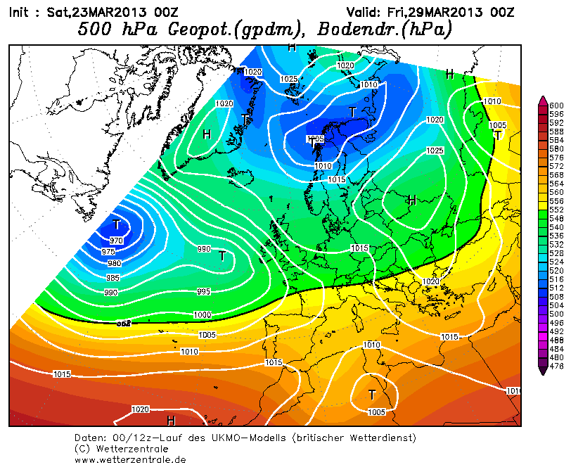
By about Wednesday, a low starts to pick up some momentum in Atlantic and this will bring some pretty decent swell in for the weekend. It's still early days for the detailed forecast but if the current prognosis pans out it'll be roast beef with all the trimmings. Confidence is pretty high as there is good alignment with the UK European and American models that

1. the low develops
2. high pressure holds firm over Scandinavia to keep the wind south-easterly over the bank holiday.

I've got a week off and plan to make the most of it.


Right I'm off down the allotment to plant some spuds, before heading down the beach.

Sunday 10 March 2013

cant see anything remotely interesting on the horizon...

.... After a seemingly endless run of offshore wind and swell, that that's now it, time to get on with something else. Call me a bender if you like, but how cold was that wind this afternoon?
<BR>

After a session in the freezer this week, high pressure looks like returning to the worst place it can be - blocked in the mid Atlantic by the weekend, with sloppy areas of high pressure over the UK ruining everything. 
<BR>
Rubbish.