
Friday, 26 October 2012
Wednesday, 24 October 2012
way-ah
After all the fun of the fair down in Cornwall last weekend, there's a boom shanker coming down the North sea this weekend. It's more or less a dream set up with a tight pressure gradient aligned north-south to the west of Norway through Thu and Fri, with low pushing its chest out on Saturday evening to turn the wind offshore. The local crew up there will be foaming at the mouth no doubt, and it looks worth the (long) trek.

That's it for a while after that - high pressure looks like ridging out to the west of the UK, in a rough line from the tip of Greenland to Iberia and its looking entrenched so don't expect to be surfing or sunbathing any time soon.

That's it for a while after that - high pressure looks like ridging out to the west of the UK, in a rough line from the tip of Greenland to Iberia and its looking entrenched so don't expect to be surfing or sunbathing any time soon.
Tuesday, 16 October 2012
le boeuf
I have had me eye on this for a while now because i thought the wind was going to be too strong offshore but, I am now coming around to the idea that this weekend is going to be rather stupendous.
The swell will build big style during Saturday, and turn into a full blown swell with a nice juicy offshore wind.
Here's the swell - - top panel swell in cm - bottom panel period in seconds

And here is the wind.

The swell will build big style during Saturday, and turn into a full blown swell with a nice juicy offshore wind.
Here's the swell - - top panel swell in cm - bottom panel period in seconds

And here is the wind.

Thursday, 11 October 2012
Big and bouncy
There is some interesting weather coming up in the next 10 days or so - a huge upper trough will develop on the eastern side of the Atlantic and the Jet will be roasting along up at the 200mb level.
The upper trough looks like one of those ones where at some stage a rather nasty low will run along the channel and do some damage to some dustbin lids and caravan parks.
If you can tuck in behind one of these lows somewhere along the south coast i suspect you'll be in business but the window will be small and timing will be everything.

next week - I should have thought there'll be some decent waves to be had in the more tucked away spots on the north coast too.
Monday, 8 October 2012
Arise
It's proper murky - but there's waves coming, so get up early tomorrow morning, dust the cobwebs off your knackers, and head down the beach.
Here's a wind chart for 0600 tomorrow morning - the tide will be pouring in about then and the wind is perfect. 11 or 12 second swell and just over a meter of open ocean oscillation and a south east wind. No doubt something will throw a spanner in the works but I see medium size perfect waves and the tide lapping in.

Its looking interesting for next week too - with proper swell and maybe favorable winds. 'bout time.
Thursday, 4 October 2012
A big fat splodge of rain is just to the west of the Bishop Rock right now and its moving east - expect to hear the patter of rain all night and perhaps even the lapping of flood water at your heels.
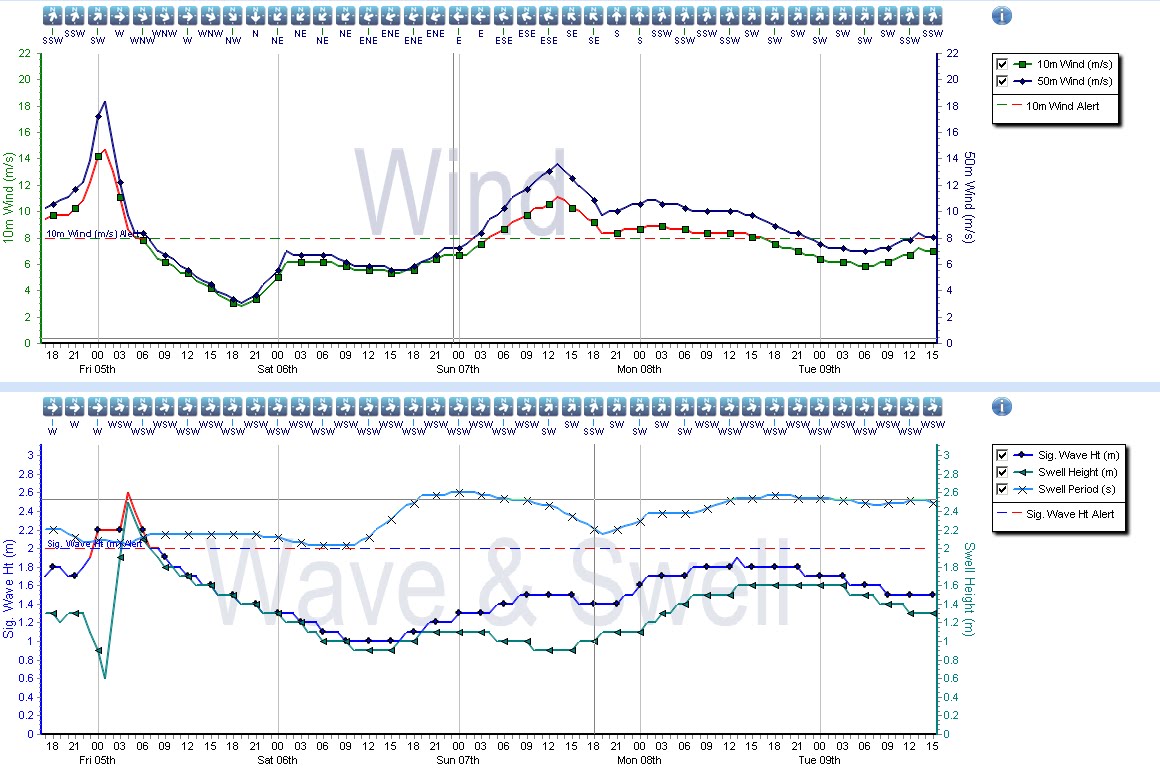
A nice pulse of swell is going to arrive on Saturday afternoon, and last for a few days. Winds look very nice for Sunday too, so there could be a bit of a bonaza if the wind behaves (it's a bit to NE on Sat and too strong on Sun) - its not locked in but there is a lot of promise.
Some of the more tucked away south coast spots that can handle a north-easterly might even light up on Saturday evening and it'll get right up the channel too.
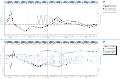
Here is a graph -
A nice pulse of swell is going to arrive on Saturday afternoon, and last for a few days. Winds look very nice for Sunday too, so there could be a bit of a bonaza if the wind behaves (it's a bit to NE on Sat and too strong on Sun) - its not locked in but there is a lot of promise.
Some of the more tucked away south coast spots that can handle a north-easterly might even light up on Saturday evening and it'll get right up the channel too.
Here is a graph -
Subscribe to:
Comments (Atom)